
Starting From
₹7400
₹ 29,500 Per Person
(Extra 5% GST)
- Get PDF
Need Help
Talk To Our Mountain Expert
- +91-9045547711
Har Ki Dun Trek Experiences
The Har Ki Dun Trek is one of the most scenic and culturally rich treks in Uttarakhand, located in the Garhwal Himalayas. Known as the Valley of Gods, Har Ki Dun offers breathtaking views of snow-covered peaks, alpine meadows, ancient villages, and lush forests. This trek is perfect for nature lovers and trekkers who want to experience both natural beauty and traditional Himalayan culture.
The trek begins from the small village of Sankri, which is a popular base for many treks in the region. As the trail progresses through villages like Taluka, Seema, and Osla, trekkers get a chance to witness the traditional lifestyle of the local Himalayan communities. Wooden houses, terraced fields, and friendly villagers make the journey even more memorable.
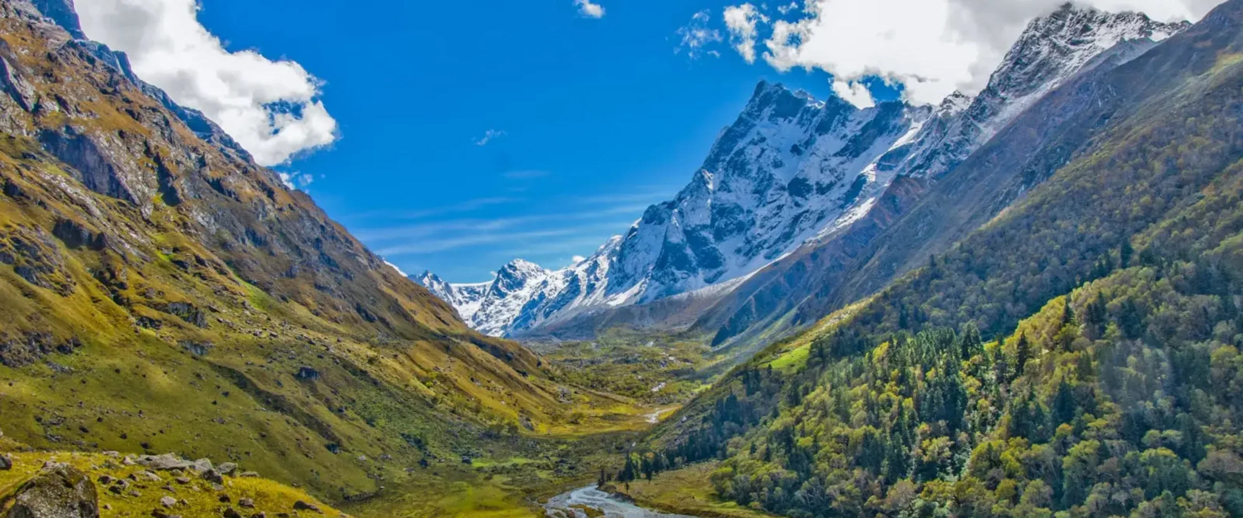
The highlight of the trek is reaching Har Ki Dun Valley, situated at an altitude of around 11,700 ft. Surrounded by majestic peaks like Swargarohini, Bandarpoonch, and Black Peak, the valley offers breathtaking panoramic views. The peaceful surroundings, flowing rivers, and wide meadows make Har Ki Dun one of the most beautiful trekking destinations in the Himalayas.
This trek is generally considered easy to moderate, making it suitable for beginners as well as experienced trekkers.
Best Time to Visit
The best time to visit Har Ki Dun Trek is from April to June and September to November.
April – June
Pleasant weather and blooming alpine meadows
Snow patches may still be visible in higher areas
July – August
Monsoon season brings lush greenery but trails may become slippery.
September – November
Clear skies and stable weather
Stunning mountain views and cool temperatures
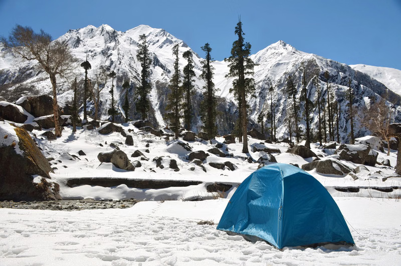
During winter months, snowfall transforms the valley into a beautiful winter wonderland but trekking becomes more challenging.
Detailed Itinerary
Day 1: Drive from Dehradun Railway Station to Sankri Base Camp
The adventure begins with a scenic drive from Dehradun Railway Station to the beautiful Himalayan village of Sankri, the base camp for several iconic treks in Uttarakhand. This long yet mesmerizing journey takes you from the plains of Dehradun deep into the Garhwal Himalayas through winding mountain roads, river valleys, pine forests, and traditional villages.
Journey Overview
| Details | Information |
|---|---|
| Starting Point | Dehradun Railway Station |
| Starting Altitude | 1,480 ft |
| Destination | Sankri |
| Destination Altitude | 6,400 ft |
| Distance | Approx. 200 km |
| Duration | 8–10 Hours |
| Terrain | Mountain roads with gradual altitude gain |
| Accommodation | Guesthouse / Campsite |
The day usually begins early morning around 6:00 AM to 7:00 AM from outside Dehradun Railway Station. After meeting the trek coordinator and fellow trekkers, the drive starts toward the remote Himalayan interiors of Uttarkashi district.
As the city slowly fades behind, the roads begin climbing into the foothills, offering beautiful views of:
- The Doon Valley
- Forest-covered hills
- Morning mountain mist
- Small roadside villages
The fresh mountain air and changing landscapes mark the beginning of the Himalayan adventure.
Scenic Destinations & Sightseeing En Route :
Mussoorie Bypass & Mountain Roads
The route passes through the Mussoorie bypass region, avoiding the busy hill station traffic while still offering:
- Curvy mountain roads
- Pine and oak forests
- Valley viewpoints
- Cool Himalayan breeze
This section introduces trekkers to the charm of Uttarakhand’s mountain terrain.
Yamuna Valley Region
Further ahead, the route enters the scenic Yamuna Valley area where the landscape becomes greener and more dramatic.
Highlights
- Terraced farming fields
- Traditional Garhwali villages
- Flowing river streams
- Dense forest patches
- Seasonal waterfalls
The peaceful countryside scenery makes this stretch extremely refreshing.
Purola – The Main Transit Town
Purola is one of the major towns on the route and serves as an important halt for breakfast or lunch
Scenic Appeal
- Pine-covered ridges
- Quiet mountain-town atmosphere
- Beautiful valley surroundings
This is also a good point to purchase last-minute essentials for the trek.
Tons River Valley
After Purola, the drive becomes even more scenic as the road enters the breathtaking Tons River Valley.
Major Attractions
- River flowing alongside the road
- Deep mountain gorges
- Deodar and pine forests
- Wooden suspension bridges
- Traditional Himalayan homes
The Tons River region is considered one of the most picturesque drives in Uttarakhand.
Mori – Riverside Himalayan Settlement
Located beside the Tons River, Mori is a peaceful mountain village known for:
- Riverside beauty
- Dense pine forests
- Adventure camps
- Wooden Himalayan architecture
Scenic Highlights
- Crystal-clear river views
- Quiet valleys
- Snow-clad mountain views during winter
- Beautiful forest landscapes
This region is especially popular among campers and photographers.
Naitwar – Gateway to Govind National Park
Netwar marks the entrance toward the Govind Pashu Vihar region and the remote Himalayan wilderness.
Attractions Along the Way
- Traditional wooden temples
- Alpine forest stretches
- Mountain streams
- Authentic Garhwali culture
As the altitude increases, the air becomes noticeably colder and fresher.
Final Stretch to Sankri
The last section of the drive toward Sankri is one of the most beautiful parts of the journey.
What Makes It Special
- Dense pine and deodar forests
- Snow-covered peaks visible in winter
- Narrow mountain roads cutting through forests
- Quiet Himalayan landscapes
The atmosphere gradually changes into a true alpine environment.
Arrival at Sankri Base Camp (6,400 ft.)
By late afternoon or evening, you arrive at the beautiful village of Sankri, located at an altitude of approximately 6,400 ft.
Sankri is a small Himalayan settlement surrounded by:
- Pine forests
- Mountain ridges
- Wooden homes
- Snowy peaks during winter
It serves as the starting point for famous treks such as:
- Kedarkantha Trek
- Har Ki Dun Trek
- Bali Pass Trek
- Phulara Ridge Trek
End of Day Summary
The drive from Dehradun Railway Station to Sankri is not just a transfer but an immersive Himalayan experience. The journey introduces trekkers to Uttarakhand’s rivers, forests, valleys, and mountain culture before the actual trek begins the following day.
Day 2: Drive from Sankri (6,309 ft.) to Dharkot/Gangad via Taluka and same day Trek to Cheludgad (8,158 ft.)/Seema (8,300 ft.)
The second day of the journey marks the true beginning of the Himalayan trekking experience. After spending the night at Sankri, the day starts with a short but adventurous mountain drive toward the remote villages of Dharkot or Gangad via Taluka, followed by a scenic riverside trek through dense forests and traditional Himalayan settlements to Cheludgad near Seema village.
This day introduces trekkers to the untouched beauty of the Govind Pashu Vihar region with stunning valley landscapes, wooden villages, suspension bridges, and views of the Supin River throughout the trail.
Journey Overview
| Details | Information |
|---|---|
| Starting Point | Sankri |
| Starting Altitude | 6,309 ft |
| Drive Route | Sankri → Taluka → Dharkot/Gangad |
| Trek Destination | Cheludgad near Seema |
| Trek Altitude | 8,158 ft |
| Drive Duration | 1.5–2 Hours |
| Trek Distance | Approx. 9–11 km |
| Trek Duration | 4–6 Hours |
| Trail Type | Gradual ascent through forests and riverside paths |
Morning at Sankri
The day begins early with sunrise views over the surrounding Himalayan ridges of Sankri. After breakfast, trekkers prepare for the drive toward Taluka.
The crisp mountain air, pine forests, and quiet village atmosphere create the perfect start for the first trekking day.
Drive from Sankri to Taluka
The drive from Sankri to Taluka is short but extremely scenic and adventurous.
Route Highlights
- Narrow mountain roads
- Dense pine and deodar forests
- Water streams crossing the road
- Views of deep valleys
- Wooden Himalayan houses
The rough terrain and off-road sections make this stretch exciting for adventure lovers.
Taluka – Trek Starting Point
Taluka is a small Himalayan village situated beside the Supin River and acts as the traditional starting point for the Har Ki Dun valley routes.
Attractions Around Taluka
- Traditional wooden homes
- Small local dhabas
- Farmlands and cattle sheds
- Forest-covered hills
The village reflects authentic Himalayan rural life and serves as an important gateway into the Govind National Park region.
Drive Further to Dharkot/Gangad
Depending on road and weather conditions, vehicles may continue further toward:
- Dharkot
- Gangad
This reduces the trekking distance and allows trekkers to reach deeper into the valley on Day 2.
Beginning the Trek to Cheludgad
The trek officially begins from the road-head region near Dharkot/Gangad.
Almost immediately, the trail enters a beautiful Himalayan landscape filled with:
- Dense walnut and pine forests
- River-side pathways
- Wooden bridges
- Mountain villages
- Water streams
The trail remains mostly gradual and comfortable, making it ideal for acclimatization.
Scenic Highlights Along the Trail :
Supin River Valley
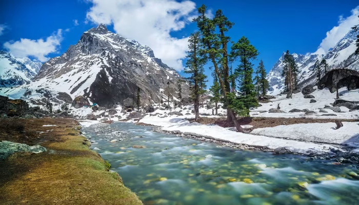
One of the most beautiful aspects of the day is trekking alongside the roaring Supin River.
Views Include
- Crystal-clear river water
- Boulder-filled riverbanks
- Forested mountain slopes
- Wooden log bridges
The sound of flowing water remains a constant companion throughout the route.
Himalayan Forests
The trail passes through rich Himalayan forests containing:
- Pine trees
- Walnut trees
- Cedar/deodar forests
- Rhododendron patches (spring season)
Wildlife & Birdlife
You may spot:
- Himalayan magpies
- Langurs
- Mountain goats
- Colorful Himalayan birds
Traditional Himalayan Villages
Small villages along the route showcase:
- Ancient wooden architecture
- Slate-roof houses
- Traditional Garhwali culture
- Terraced farming fields
Villagers are often seen:
- Grazing cattle
- Carrying firewood
- Working in fields
This section provides a glimpse into remote Himalayan life untouched by urbanization.
Gangad Village
Gangad is among the most picturesque villages in the Har Ki Dun valley region.
Famous For
- Wooden mountain homes
- Scenic valley location
- Apple orchards
- Traditional culture
The village beautifully blends with the surrounding forests and mountains.
Arrival at Cheludgad Camp near Seema
After several hours of gradual trekking, trekkers arrive at the campsite near Seema/Cheludgad at approximately 8,158 ft.
The campsite is beautifully located beside forests and river valleys, surrounded by towering Himalayan mountains.
End of Day Experience
Day 2 offers the perfect introduction to Himalayan trekking — combining adventurous mountain roads, riverside landscapes, forests, remote villages, and peaceful camping. The gradual ascent from Sankri to Cheludgad near Seema allows trekkers to acclimatize comfortably while experiencing the raw natural beauty of the Har Ki Dun valley region.
Day 3: Drive from Seema/Cheludgad Camp (8,300 ft.) to Boslo (10,400 ft.) via ancient Osla Villege (9,000 ft.)
Day 3 takes trekkers deeper into the breathtaking Har Ki Dun valley region, where the landscapes become more dramatic, the forests denser, and the Himalayan culture more prominent. The trail from Seema/Cheludgad to Boslo passes through the legendary ancient village of Osla — one of the most culturally rich and visually stunning settlements in Uttarakhand.
The day combines riverside trails, wooden bridges, dense alpine forests, traditional Himalayan architecture, and spectacular mountain views, making it one of the most memorable sections of the journey.
Journey Overview
| Details | Information |
|---|---|
| Starting Point | Seema/Cheludgad Camp |
| Starting Altitude | 8,300 ft |
| Major Stop | Osla |
| Osla Altitude | 9,000 ft |
| Destination | Boslo Campsite |
| Destination Altitude | 10,400 ft |
| Trek Distance | Approx. 10–12 km |
| Trek Duration | 5–7 Hours |
| Trail Type | Gradual ascent through forests and mountain villages |
| Difficulty Level | Moderate |
Morning at Seema/Cheludgad Camp
The day begins with a peaceful Himalayan morning beside the river valley near Seema/Cheludgad camp.
Trekkers wake up to:
- Fresh mountain air
- Sounds of the Supin River
- Snow-clad peaks in the distance
- Forest-covered slopes glowing in morning sunlight
After breakfast, the trek resumes deeper into the valley toward Osla and Boslo.
Trek Through the Supin Valley
The trail initially follows the scenic Supin River and gradually ascends through dense forests and mountain paths.
Scenic Highlights Along the Route
- Wooden bridges over glacial streams
- Pine and deodar forests
- Rocky mountain trails
- Waterfalls and river crossings
- Alpine vegetation
The route offers continuous panoramic views of the surrounding Himalayan landscape.
Ancient Himalayan Village – Osla (9,000 ft.)
Osla is among the oldest and most culturally significant villages in the Har Ki Dun region. Perched on a mountainside overlooking the valley, the village is famous for its centuries-old wooden architecture and mythological connections.
Highlights of Osla Village :
Traditional Wooden Architecture
Osla is known for:
- Intricately carved wooden houses
- Slate-roof mountain homes
- Narrow stone pathways
- Ancient Himalayan construction style
The village beautifully preserves traditional Garhwali heritage.
Someshwar Temple
One of the major attractions in Osla is the ancient Someshwar Temple.
Temple Features
- Wooden carvings
- Traditional Himalayan design
- Mythological importance
- Unique mountain architecture
Local legends connect the region to stories from the Mahabharata era, adding cultural depth to the experience.
Himalayan Village Culture
The village offers a glimpse into remote mountain life where locals continue traditional lifestyles.
Trekkers may observe:
- Farming on terraced fields
- Villagers weaving wool
- Livestock grazing
- Traditional wooden grain storage structures
The hospitality of the local community is one of the highlights of the trek.
Scenic Views from Osla
The elevated location of Osla offers stunning panoramic views of:
- Deep Himalayan valleys
- Snow-covered ridges
- Dense forests
- River gorges below
During clear weather, the mountain scenery becomes exceptionally dramatic.
Trek Beyond Osla Toward Boslo
After exploring Osla, the trail gradually climbs toward Boslo campsite.
This section becomes quieter and more alpine in character.
Forest & Alpine Landscape
As altitude increases, the environment changes noticeably.
Natural Beauty Includes
- Thick deodar forests
- Rhododendron patches
- Open meadows
- Snow patches during colder months
- High mountain ridges
The peaceful wilderness atmosphere becomes more pronounced with fewer settlements along the route.
Boslo Campsite (10,400 ft.)
By afternoon or early evening, trekkers reach Boslo campsite located at approximately 10,400 ft.
The campsite is surrounded by:
- Alpine forests
- Open mountain clearings
- Snow-clad Himalayan peaks
- Vast valley landscapes
Boslo serves as a beautiful high-altitude camping location before moving further toward the upper Har Ki Dun region.
Camp Experience at Boslo
Evening Atmosphere
The evenings at Boslo are peaceful and cold, offering:
- Clear starry skies
- Crisp mountain air
- Quiet wilderness surroundings
- Stunning sunset colors over Himalayan ridges
Photography Highlights
Boslo and Osla together provide some of the best photography opportunities of the trek.
Best Subjects
- Ancient wooden houses
- Traditional Himalayan temples
- Forest trails
- Mountain landscapes
- River valleys
- Alpine sunsets
End of Day Experience
Day 3 is one of the cultural and scenic highlights of the journey. The trek from Seema/Cheludgad to Boslo via Osla beautifully combines Himalayan wilderness with ancient mountain heritage. From riverside forests to centuries-old wooden villages and alpine campsites, the day offers an immersive experience into the untouched beauty and traditions of the Garhwal Himalayas.
Day 4: Trek from Boslo (10,400 ft.) to Har Ki Dun (11,600 ft.) to Maninda Lake (12,500 ft.) & back to Boslo (10,400 ft.)
Day 4 is the most spectacular and rewarding day of the expedition, taking trekkers into the legendary Valley of Gods — Har Ki Dun — followed by an adventurous excursion to the pristine alpine waters of Maninda Lake. The day unfolds through breathtaking Himalayan landscapes featuring vast alpine meadows, glacier-fed streams, snow-covered peaks, ancient valleys, and dramatic mountain panoramas.
This section of the trek offers some of the finest views in the Garhwal Himalayas and provides a true high-altitude wilderness experience.
Journey Overview
| Details | Information |
|---|---|
| Starting Point | Boslo Campsite |
| Starting Altitude | 10,400 ft |
| First Destination | Har Ki Dun |
| Har Ki Dun Altitude | 11,600 ft |
| Second Destination | Maninda Lake |
| Maninda Lake Altitude | 12,500 ft |
| Return Point | Boslo Campsite |
| Total Trek Duration | 7–9 Hours |
| Trek Type | Alpine valley trek with gradual and steep sections |
| Difficulty Level | Moderate to Challenging |
Early Morning at Boslo
The day begins before sunrise at Boslo campsite.
Trekkers wake up to:
- Crisp mountain air
- Golden sunlight on snow peaks
- Silence of alpine forests
- Stunning Himalayan morning views
After an early breakfast, the trek proceeds toward the upper Har Ki Dun valley.
Trek from Boslo to Har Ki Dun Valley
The trail gradually ascends through some of the most beautiful alpine terrain in Uttarakhand.
Scenic Highlights Along the Route :
Alpine Meadows
The forests slowly open into wide Himalayan meadows filled with:
- Seasonal wildflowers
- Grazing cattle and sheep
- Crystal-clear streams
- Expansive valley views
During spring and summer, the meadows become vibrant with alpine flora.
Glacier-Fed Streams
Several streams originating from surrounding glaciers cross the trail.
Features
- Ice-cold water
- Wooden log bridges
- Rocky stream crossings
- Waterfalls descending from mountain slopes
The sound of flowing water accompanies trekkers throughout the valley.
Arrival at Har Ki Dun (11,600 ft.)
Har Ki Dun, often called the “Valley of Gods,” is one of the most beautiful glacial valleys in the Indian Himalayas.
Surrounded by towering peaks and alpine landscapes, the valley offers breathtaking panoramic views.
Highlights of Har Ki Dun Valley:
Panoramic Himalayan Peaks
On clear days, trekkers can witness spectacular views of:
- Swargarohini massif
- Black Peak (Kala Nag)
- Hata Peak
- Jaundhar Glacier region
The valley is enclosed by snow-covered ridges and dramatic mountain walls.
Mythological Importance
According to local legends:
- The Pandavas are believed to have passed through this valley on their journey to heaven via Swargarohini.
- The region is deeply connected with stories from the Mahabharata.
This spiritual and mythological significance adds a unique aura to the valley.
Alpine Landscape
The valley features:
- Wide green meadows
- Glacier moraines
- River channels
- Snow patches
- Dense conifer forests in lower sections
The untouched wilderness makes Har Ki Dun one of the most scenic trekking destinations in Uttarakhand.
Trek Further to Maninda Lake (12,500 ft.)
After spending time in Har Ki Dun, trekkers continue toward the higher alpine zone leading to Maninda Lake.
This section becomes more rugged and adventurous.
Trail Features Toward Maninda Lake:
Rocky Alpine Terrain
The route includes:
- Rocky mountain paths
- Boulder sections
- Steeper ascents
- Open alpine ridges
As altitude increases, vegetation becomes sparse and the landscape turns dramatically alpine.
High Himalayan Views
The climb rewards trekkers with:
- Expansive valley panoramas
- Glacier views
- Snowfields during colder months
- Vast Himalayan horizons
The higher altitude creates an isolated wilderness atmosphere.
Maninda Lake (12,500 ft.)
Maninda Lake is a pristine high-altitude alpine lake nestled amidst rugged Himalayan terrain.
Lake Features
- Crystal-clear glacial water
- Rocky surroundings
- Snow-fed ecosystem
- Reflection of surrounding peaks on calm days
The peaceful setting and untouched environment make it a perfect resting and photography point.
Photography Highlights
This day offers some of the best photography opportunities of the entire trek.
Best Subjects
- Snow-capped Himalayan peaks
- Alpine meadows
- Glacier-fed streams
- Har Ki Dun valley landscapes
- Reflection shots at Maninda Lake
- Sunrise and cloud formations
Return Trek to Boslo
After spending time at Maninda Lake, trekkers descend back through Har Ki Dun valley toward Boslo campsite.
The return journey provides:
- Different lighting conditions for photography
- Sunset views over mountain ridges
- Peaceful evening atmosphere in the valley
The gradual descent makes the return relatively comfortable despite the long day.
Evening at Boslo Campsite
Upon returning to Boslo:
- Hot tea/snacks are served
- Trekkers relax and recover
- Dinner is served early due to cold temperatures
Night Experience
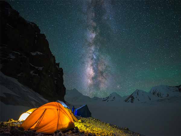
At this altitude, the night sky often appears exceptionally clear with:
- Visible Milky Way
- Bright constellations
- Cold alpine winds
- Complete mountain silence
End of Day Experience
Day 4 is the crown jewel of the journey — combining the legendary beauty of Har Ki Dun with the raw alpine wilderness of Maninda Lake. From glacier-fed valleys and mythological landscapes to towering Himalayan peaks and pristine alpine waters, the day delivers an unforgettable high-altitude Himalayan adventure before returning to the peaceful forests of Boslo campsite.
Day 5: Trek from Boslo (10,400 ft.) to Seema Campsite (8,300 ft.)
After the spectacular high-altitude exploration of Har Ki Dun and Maninda Lake, Day 5 is a scenic descent from the alpine wilderness of Boslo back toward the lush river valleys near Seema. The trail retraces the beautiful route through dense forests, ancient Himalayan villages, wooden bridges, and the roaring Supin River valley.
Compared to the previous day, this section feels more relaxed and immersive, allowing trekkers to fully absorb the cultural beauty and peaceful landscapes of the Har Ki Dun region.
Journey Overview
| Details | Information |
|---|---|
| Starting Point | Boslo Campsite |
| Starting Altitude | 10,400 ft |
| Destination | Seema Campsite |
| Destination Altitude | 8,300 ft |
| Trek Distance | Approx. 10–12 km |
| Trek Duration | 4–6 Hours |
| Trail Type | Gradual descent through forests and villages |
| Difficulty Level | Easy to Moderate |
Morning at Boslo Campsite
The day begins with a calm Himalayan morning at Boslo surrounded by alpine forests and towering mountain ridges.
Trekkers wake up to:
- Crisp mountain air
- Golden sunlight over peaks
- Mist-covered valleys
- Peaceful wilderness surroundings
After breakfast, the descent toward Seema begins.
Descending Through the Har Ki Dun Valley
The trail gradually descends through beautiful Himalayan terrain that appears even more scenic while returning.
Scenic Highlights Along the Route:
Alpine Forest Trails
The route passes through dense stretches of:
- Pine forests
- Deodar forests
- Walnut trees
- Rhododendron patches
The cool forest shade and fresh mountain air make the descent pleasant and comfortable.
Mountain Streams & Wooden Bridges
Throughout the descent, trekkers encounter:
- Glacier-fed streams
- Small waterfalls
- Traditional wooden bridges
- Rocky riverside paths
The sound of flowing water continues to accompany the trail.
Return Through Osla Village
The trek once again passes through the ancient Himalayan village of Osla, allowing trekkers another opportunity to experience its traditional mountain culture.
Highlights of Osla During Return :
Traditional Himalayan Architecture
Osla remains one of the most visually unique villages in Uttarakhand with:
- Intricately carved wooden homes
- Stone-paved pathways
- Traditional slate roofs
- Ancient Himalayan craftsmanship
Village Life & Culture
Trekkers may observe:
- Locals working in terraced fields
- Wool weaving and farming activities
- Livestock grazing
- Children playing along village trails
The peaceful atmosphere of Osla provides a rare glimpse into remote Himalayan life.
Ancient Someshwar Mahadev Temple
The iconic Someshwar Temple remains one of the cultural highlights of the region.
Temple Features
- Detailed wooden carvings
- Traditional Himalayan architecture
- Historical and mythological significance
Many trekkers pause here briefly for photography and exploration.
Valley & Mountain Views
The descending trail offers beautiful panoramic views of:
- Deep river valleys
- Snow-covered ridges in the distance
- Dense conifer forests
- Himalayan cliff faces
As altitude decreases, the landscape gradually becomes greener and denser.
Supin River Valley Section
The trail eventually rejoins the scenic Supin River valley near Seema.
Major Attractions
- Crystal-clear flowing river
- Boulder-filled riverbanks
- Suspension bridges
- Riverside camping areas
The valley feels warmer and more vibrant compared to the higher alpine zone.
Arrival at Seema Campsite (8,300 ft.)
By afternoon, trekkers arrive at Seema campsite located near the riverside forest region.
The campsite is beautifully surrounded by:
- Dense forests
- River valleys
- Wooden mountain settlements
- Towering Himalayan slopes
After several days at higher altitude, the lower elevation often feels more comfortable and relaxing.
Campsite Experience :
Evening Atmosphere
The Seema campsite offers:
- Relaxing riverside ambiance
- Forest sounds and flowing river nearby
- Warm evening gatherings
- Peaceful mountain environment
The campsite becomes especially beautiful during sunset as golden light illuminates the surrounding valley.
Photography Highlights
Day 5 offers excellent opportunities for:
- Forest trail photography
- Traditional village portraits
- River valley landscapes
- Wooden Himalayan architecture
- Sunset views over Seema valley
End of Day Experience
Day 5 offers a beautiful transition from the alpine wilderness of Boslo back into the lush river valleys near Seema. The descent through Osla, forest trails, and the Supin River valley creates a peaceful and culturally rich trekking experience. The relaxed pace, scenic landscapes, and riverside camping atmosphere make it one of the most enjoyable and refreshing days of the journey.
Day 6: Trek from Seema (8,300 ft.) to Dharkot Village (8,400 ft.) to Sankri base camp (6,400 ft.)
Day 6 marks the final trekking day of the journey as trekkers descend from the peaceful riverside forests of Seema back toward civilization through the scenic Himalayan villages of the Har Ki Dun valley. The day combines a short downhill trek to Dharkot village followed by a drive back to Sankri.
The route offers one last opportunity to experience the untouched beauty of the Govind Pashu Vihar region — crossing wooden bridges, passing through dense forests, riverside trails, and traditional Garhwali settlements before returning to the base camp.
Journey Overview
| Details | Information |
|---|---|
| Starting Point | Seema Campsite |
| Starting Altitude | 8,300 ft |
| Trek Destination | Dharkot Village |
| Dharkot Altitude | 8,400 ft |
| Final Destination | Sankri |
| Sankri Altitude | 6,400 ft |
| Trek Distance | Approx. 8–10 km |
| Trek Duration | 3–5 Hours |
| Drive Duration | 1.5–2 Hours |
| Difficulty Level | Easy to Moderate |
Morning at Seema Campsite
The morning begins beside the peaceful Supin River valley near Seema campsite.
Trekkers wake up to:
- Fresh mountain breeze
- Forest-covered valley views
- Sounds of flowing river water
- Sunrise over Himalayan ridges
After breakfast, the campsite is packed up and the final trekking stretch begins.
Trek Through Forest & Riverside Trails
The trail from Seema toward Dharkot retraces the beautiful riverside route through the lower Har Ki Dun valley.
Scenic Highlights Along the Trail :
Dense Himalayan Forests
The descending trail passes through:
- Pine forests
- Cedar/deodar trees
- Walnut groves
- Fern-covered forest sections
The cool shade and rich greenery make the walk pleasant and relaxing.
Supin River Views
The roaring Supin River continues flowing beside sections of the trail.
Scenic Features
- Boulder-filled riverbanks
- Wooden bridges
- Waterfalls and mountain streams
- River valley viewpoints
The valley scenery remains stunning throughout the descent.
Traditional Himalayan Settlements
As trekkers descend further, the trail passes through remote mountain settlements reflecting authentic Garhwali culture.
Village Life Includes
- Wooden houses with slate roofs
- Terraced farming
- Locals tending livestock
- Traditional Himalayan lifestyle
The route offers a final glimpse into the peaceful rhythm of life in Uttarakhand’s remote villages.
Arrival at Dharkot Village (8,400 ft.)
Dharkot serves as the road-head point for vehicles coming from Sankri/Taluka side.
The village is surrounded by:
- Forest-covered hills
- River valleys
- Traditional mountain homes
- Agricultural terraces
Trekkers usually rest here briefly before beginning the drive back toward Sankri.
Drive from Dharkot to Sankri
Vehicles pick up trekkers from Dharkot for the scenic mountain drive back to Sankri.
Route Highlights During Drive :
Forest Roads & Valley Views
The drive offers:
- Narrow mountain roads
- Dense pine forests
- Water stream crossings
- Beautiful valley landscapes
The familiar route now feels nostalgic after several days spent deep in the mountains.
Passing Through Taluka Region
The drive passes near Taluka, where the trekking journey originally began.
Trekkers often notice:
- Local villagers carrying supplies
- Mules transporting goods
- Traditional Himalayan rural life
Return to Sankri Base Camp
By afternoon or evening, trekkers return to Sankri base camp at approximately 6,400 ft.
After days spent in remote alpine terrain, Sankri feels lively and comfortable.
Evening at Sankri
The evening is generally relaxed and celebratory.
Common Activities
- Hot tea and snacks
- Relaxation and recovery
- Sharing trek experiences
- Exploring Sankri village
- Farewell dinner with trekking team
Scenic Beauty Around Sankri
The village remains surrounded by:
- Pine forests
- Himalayan ridges
- Wooden mountain homes
- Snow-clad peaks during winter
The peaceful atmosphere makes Sankri an ideal final stop before returning to Dehradun.
End of Day Experience
Day 6 provides a peaceful conclusion to the trekking journey through the Har Ki Dun valley. The descent from Seema to Dharkot through forests, riverside trails, and traditional Himalayan villages offers a final immersive experience of the Garhwal Himalayas before returning to Sankri. The evening at Sankri becomes a time for relaxation, reflection, and celebration after completing an unforgettable Himalayan adventure
Day 7: Drive from Sankri (6,400ft.) to Dehradun (1,480 ft.)
Day 7 marks the final day of the journey as trekkers bid farewell to the peaceful Himalayan village of Sankri and begin the long scenic drive back to Dehradun. After several days spent amidst alpine valleys, forests, rivers, and remote mountain villages, the return journey offers one last opportunity to experience the stunning landscapes of the Garhwal Himalayas.
The drive retraces the beautiful route through pine forests, river valleys, mountain settlements, and winding Himalayan roads before descending into the Doon Valley.
Journey Overview
| Details | Information |
|---|---|
| Starting Point | Sankri |
| Starting Altitude | 6,400 ft |
| Destination | Dehradun |
| Destination Altitude | 1,480 ft |
| Distance | Approx. 200 km |
| Drive Duration | 8–10 Hours |
| Route | Sankri → Netwar → Mori → Purola → Naugaon → Dehradun |
Morning at Sankri
The final morning in Sankri begins with serene Himalayan views and crisp mountain air.
Trekkers wake up to:
- Pine-covered mountain slopes
- Early sunlight on distant peaks
- Peaceful village surroundings
- Cool alpine breeze
After breakfast, luggage is loaded into vehicles and the return drive begins.
Farewell to Sankri
As vehicles leave Sankri behind, trekkers get final glimpses of:
- Traditional wooden houses
- Forested ridgelines
- Snow-covered peaks during winter
- Quiet Himalayan village life
The return often feels nostalgic after spending days immersed in mountain wilderness.
Scenic Highlights During the Return Drive :
Govind Pashu Vihar Region
The road initially passes through the beautiful Govind National Park region.
Attractions
- Dense pine and deodar forests
- Deep mountain valleys
- Water streams crossing roads
- Himalayan birdlife
Morning light often enhances the beauty of the forest landscapes.
Naitwar
Netwar marks one of the first major settlements on the route back.
Scenic Features
- Traditional mountain homes
- Forest-covered hillsides
- River crossings
- Small roadside tea stalls
This section offers beautiful valley and river views.
Mori – Riverside Himalayan Town
The drive continues through Mori, one of the most scenic settlements in the Tons River valley.
Highlights of Mori :
Tons River Views
The road runs alongside the stunning Tons River featuring:
- Crystal-clear flowing water
- Boulder-filled riverbanks
- Suspension bridges
- Riverside camps and forests
Forest Landscapes
Mori is surrounded by:
- Dense pine forests
- Cedar trees
- Green valleys
- Snowy mountain backdrops during winter
The region is especially popular among nature lovers and photographers.
Tons River Valley Drive
One of the most beautiful sections of the return journey is the drive along the Tons River valley.
Scenic Beauty Includes
- Mountain cliffs
- River gorges
- Waterfalls
- Curving Himalayan roads
- Traditional wooden villages
This route offers continuous panoramic Himalayan scenery.
Purola – Main Transit Stop
Purola generally serves as the major refreshment and meal stop during the return drive.
Common Facilities
- Restaurants and dhabas
- Tea stalls
- ATM access
- Grocery shops
- Mobile network availability
Trekkers often enjoy a relaxed lunch break here before continuing toward Dehradun.
Descending Toward Dehradun
As the drive progresses:
- Mountain roads gradually widen
- Valleys become broader
- Temperatures grow warmer
- Urban signs begin reappearing
The landscape slowly transitions from remote Himalayan wilderness to the foothills of Uttarakhand.
Doon Valley Views
Approaching Dehradun, trekkers witness:
- Expansive valley landscapes
- Forested foothills
- City lights during evening arrivals
- Busy roadside markets and traffic
The contrast between mountain solitude and city life becomes immediately noticeable.
Arrival at Dehradun (1,480 ft.)
By evening, trekkers usually arrive back at:
- Dehradun Railway Station
- Nearby drop-off points in Dehradun
End of Journey Experience
The drive from Sankri back to Dehradun offers a reflective and scenic conclusion to the Har Ki Dun adventure. As the mountains slowly fade behind, trekkers carry back unforgettable memories of alpine valleys, ancient villages, glacier-fed rivers, forests, and the timeless beauty of the Garhwal Himalayas.
Accommodation in tents / guesthouses during trek
All meals during trekking days
Experienced trek leader and guides
Support staff (cook and helpers)
Camping equipment (tents, sleeping bags, mattresses)
First-aid kit and medical assistance
Forest permits and entry fees
What’s Included
What’s Not Included
Travel to and from Dehradun
Personal trekking gear
Personal expenses (snacks, beverages, tips)
Travel insurance
Emergency evacuation charges
Any services not mentioned in inclusions
TREK ESSENTIALS
- Warm jacket or fleece
- Thermal innerwear
- Waterproof jacket / poncho
- Trekking pants and extra socks
- Gloves and woolen cap
- High-ankle trekking shoes with good grip
- Backpack (40–50L)
- Water bottle (1–2 litres)
- Sunglasses (UV protected)
- Sunscreen & lip balm
- Personal medicines
- Headlamp / torch
- Power bank
- Valid ID proof